


October 9th, 2025 | by Caitlin Boyarsky
Camel’s Hump, how do I love thee? Let me count the ways…
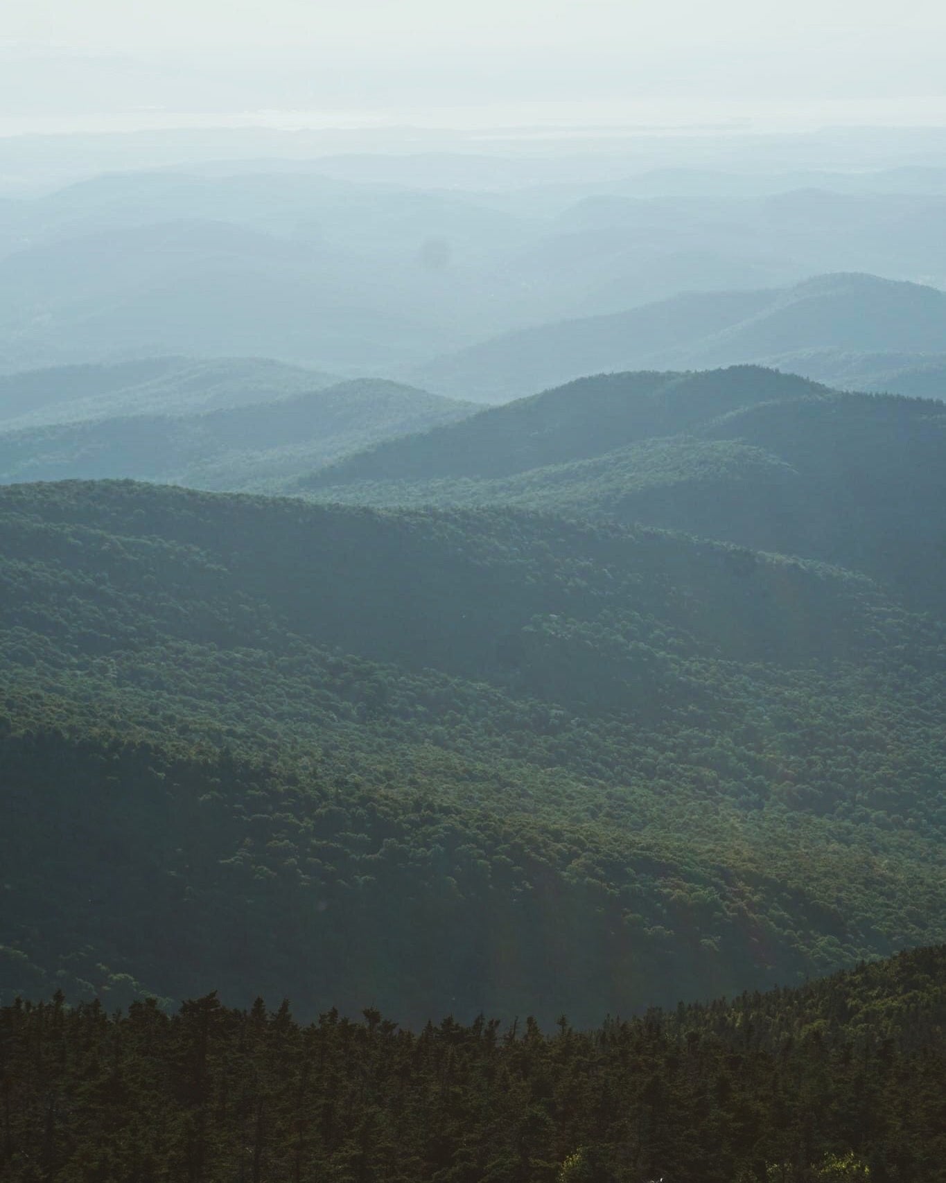
Vermont is home to over 1,300 mountains. Vermont’s mountains look a bit different from the towering ones you may see out in the western part of the United States, with only a handful of them reaching a height of 4,000 feet or more. These ancient mountains were once tall and jagged, but over hundreds of millions of years they have eroded down to the soft rolling, tree-covered Green Mountains you see in the state today.
Camel’s Hump, how do I love thee? Let me count the ways…
Vermont is home to over 1,300 mountains. Vermont’s mountains look a bit different from the towering ones you may see out in the western part of the United States, with only a handful of them reaching a height of 4,000 feet or more. These ancient mountains were once tall and jagged, but over hundreds of millions of years they have eroded down to the soft rolling, tree-covered Green Mountains you see in the state today.
The name Vermont actually comes from the French words for green (Vert) and mountain (Mont). The Green Mountains are a mountain range that acts like a backbone for the state, running from the southern border to the northern border for roughly 250 miles. The lucky few that reach 4,000 ft in elevation are known as the “Vermont Five.” Third tallest on this exclusive list is Camel’s Hump at 4,083 ft.
While it may not be the tallest mountain in Vermont, it’s arguably one of the most special mountains in the state. Its unique shape, which resembles two humps on a camel’s back (hence the name) has become an iconic symbol for Vermont in many ways. It even appears in the Vermont coat of arms and on the state Quarter from 2001. The Native Abenaki of this region knew the mountain as Tawapodiiwajo which roughly translates to “place to sit in Mountain” in English.
This special mountain can be seen just a few minutes down the road from our office, poking out from the surrounding rolling hills. Calling us to explore its rugged trails.

The mountain is a part of Camel’s Hump State Park which is a large piece of preserved land in the state of Vermont. In the late 19th century, the state attempted to build roads up the mountain, with hopes of there being a hotel at the top. The grade was too steep for good roads and the hotel they built eventually burned down so that dream faded away. The land was logged, purchased, and wasn’t really a place for recreation until it was donated to the state to become preserved land.
Later, in the early 20th century, proper hiking trails were built. These new trails were a part of a state project to allow more Vermont residents to recreate on the land. Nowadays, the state prohibits any construction on the mountain so the landscape remains relatively untouched and rugged. Perhaps helping to create its adventurous and alluring reputation today.

Growing up in New England, and Vermont specifically, I spent a lot of time outdoors hiking the beautiful mountainous landscape. I can thank my mother and father for that. They got my siblings and I backpacking around the Adirondacks in New York as young as 5 years old. We would carry our food and clothes on our backs into camp and would often pass other hikers who were impressed we were out there so young. This was normal for us though, we lived just a 15 minute drive away from Camel’s Hump and had been exploring the mountain since before we could walk, in a backpack on our parent’s backs. Backpacking was only the natural next step.
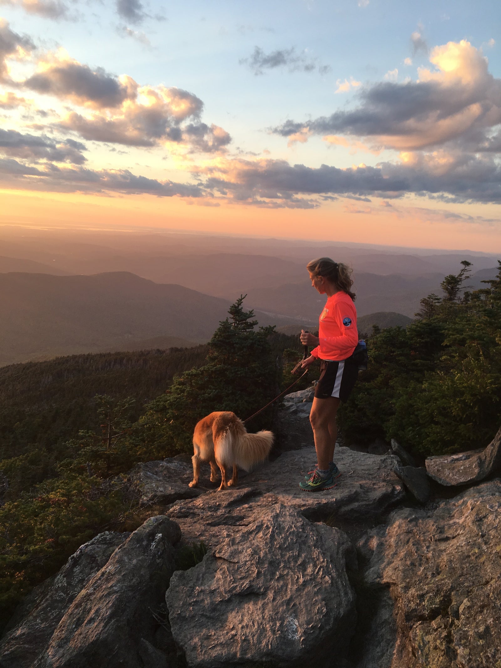
Living near the base of Camel’s Hump meant we spent many weekends there, even in the cold harsh Vermont winter when the trail would become a sheet of ice. We came to know every inch of the Burrows Trail, which is the main hiking trail from the Huntington side. The trail is both steep and technical with lots of rocks and roots to climb over. In the short 2.4 mile hike, you gain around 2,400 ft of elevation. It’s a bit of a lung-burner, but I promise the views are worth it, especially if you can catch a good sunset.
Growing up in New England, and Vermont specifically, I spent a lot of time outdoors hiking the beautiful mountainous landscape. I can thank my mother and father for that. They got my siblings and I backpacking around the Adirondacks in New York as young as 5 years old. We would carry our food and clothes on our backs into camp and would often pass other hikers who were impressed we were out there so young. This was normal for us though, we lived just a 15 minute drive away from Camel’s Hump and had been exploring the mountain since before we could walk, in a backpack on our parent’s backs. Backpacking was only the natural next step.
Living near the base of Camel’s Hump meant we spent many weekends there, even in the cold harsh Vermont winter when the trail would become a sheet of ice. We came to know every inch of the Burrows Trail, which is the main hiking trail from the Huntington side. The trail is both steep and technical with lots of rocks and roots to climb over. In the short 2.4 mile hike, you gain around 2,400 ft of elevation. It’s a bit of a lung-burner, but I promise the views are worth it, especially if you can catch a good sunset.
My parents made hiking Camel’s Hump fun for my siblings and I by bringing us Fig Newtons or Twizzlers as a trail snack and a prize for successfully getting to the top. In the winter, we would carry sleds up on our backs and fly down the trail, yelling out to hikers below us to watch out. (If you want to try this, I highly recommend bringing a helmet for the way down).
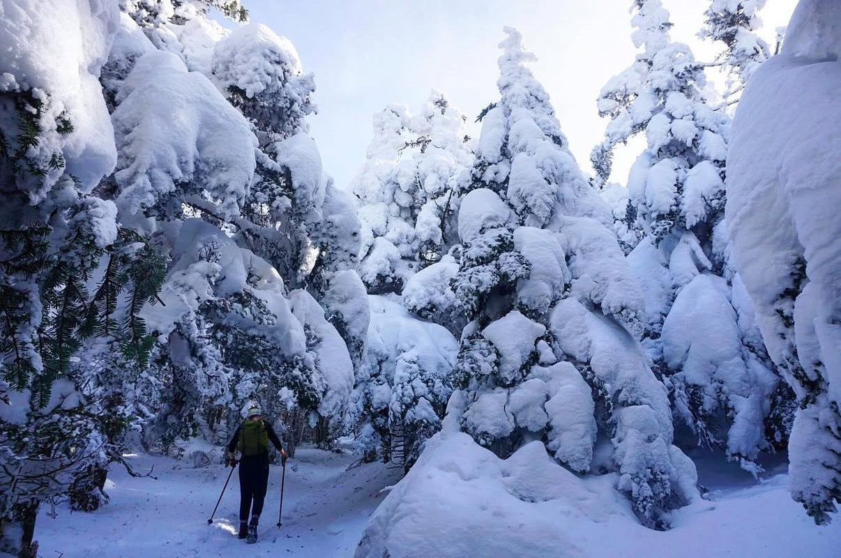
If sledding is not your thing, skiing the mountain is a whole different adventure I recommend. The skinning route starts by going up the Burrows trail and eventually forks off into the glades of Bald Hill, on the western side of the mountain. Once you reach these glades, it's a bit of a “pick your own adventure” to the top. It's always nice when someone has set a good skin track before you to follow. I’ve had some of my favorite backcountry skiing days here. The views of the top of Camel’s Hump from the top of Bald Hill are stunning.
My parents made hiking Camel’s Hump fun for my siblings and I by bringing us Fig Newtons or Twizzlers as a trail snack and a prize for successfully getting to the top. In the winter, we would carry sleds up on our backs and fly down the trail, yelling out to hikers below us to watch out. (If you want to try this, I highly recommend bringing a helmet for the way down).
If sledding is not your thing, skiing the mountain is a whole different adventure I recommend. The skinning route starts by going up the Burrows trail and eventually forks off into the glades of Bald Hill, on the western side of the mountain. Once you reach these glades, it's a bit of a “pick your own adventure” to the top. It's always nice when someone has set a good skin track before you to follow. I’ve had some of my favorite backcountry skiing days here. The views of the top of Camel’s Hump from the top of Bald Hill are stunning.
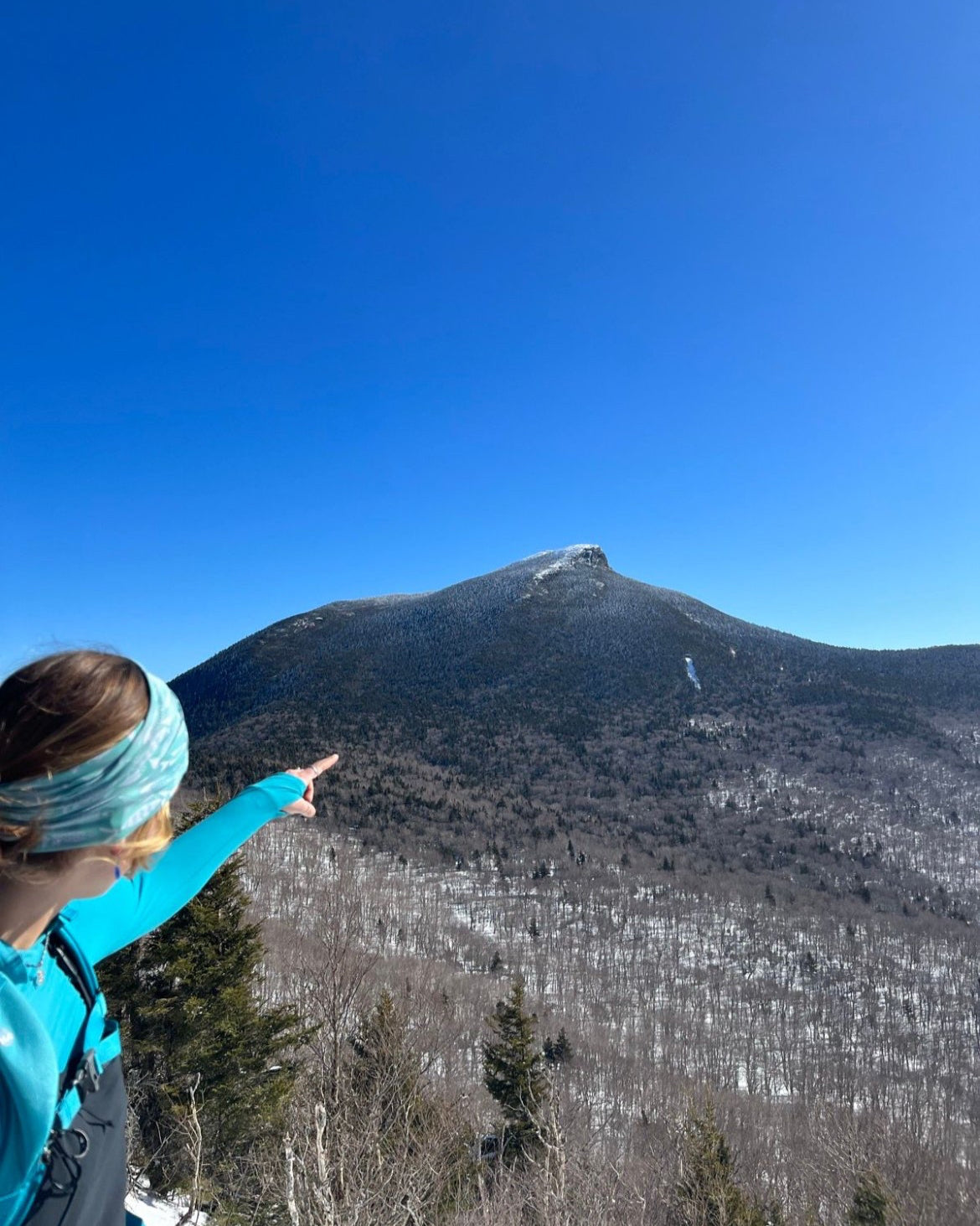
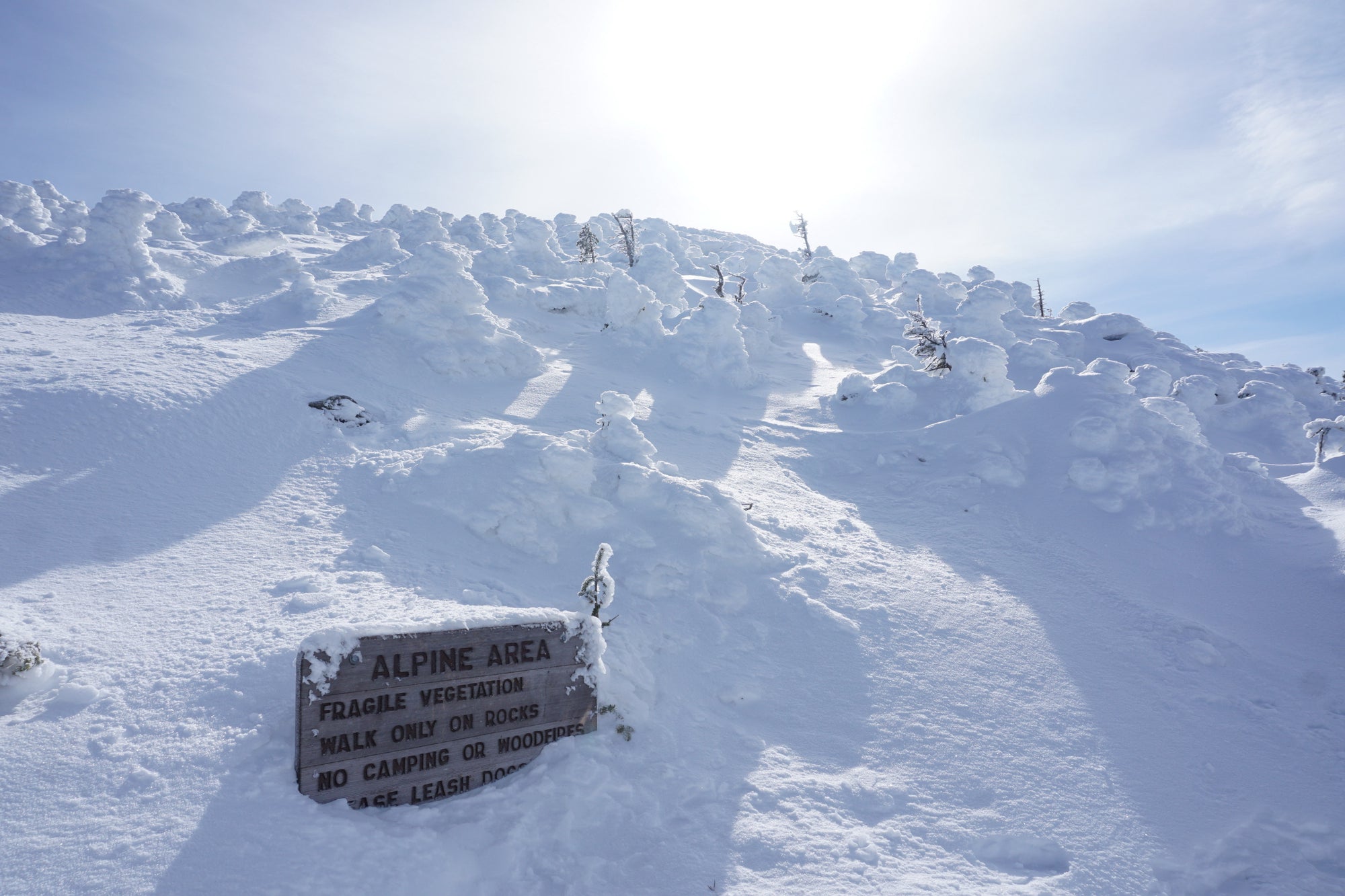
In the summer, the mountain is densely covered in green, leaving only the very top exposed with its rocky surface. The top of Camel’s Hump is a part of the very small alpine tundra left in the state. Roughly 10 acres of the top of Camel’s Hump falls within this category. The state works hard to protect this area and hiking on the plants is strongly discouraged to protect this delicate but important ecosystem, left over from the last ice-age.
In the fall, the lush green gives way for pops of red, yellow, and orange. If you’re looking for some good views of the foliage, look no further. The mountain and the surrounding land is covered with trees like the sugar maple and yellow birch which offer a vast display of colors.
Being able to enjoy the beauty of mountains like Camel’s Hump is one of the many gifts of living in Vermont. At Bivo, we cherish having the beloved mountain so close to us. When we feel like escaping for a quick adventure, we don't have to go far.
This excerpt from the Vermont state song sums up our love for Camel’s Hump perfectly:
“They say home is where the heart is
These Green Mountains are my home
These Green Mountains are my home”


Edward Hamel
October 13, 2025
Great story and mountain, Caitlin. I’ve been fortunate to have been there a few times. I also enjoy fig newtons from my backpack. You should ask Carina about her experience with fig newtons.